
Features
Business
Proving its worth
How LiDAR is evolving and changing the drainage industry
May 6, 2024 By Richard Kamchen
 A contour map generated on-the-fly using LiDAR data housed on the Ontario GeoHub.
 Light Detection and Ranging (LiDAR) technology is a valuable tool in the planning and design of tile drainage projects.
Contractors can use LiDAR to generate topography maps to give them an idea about the shape of the land to plan a drainage system without physically driving to a field to collect data, explains Nate Cook, Cook’s AGPS LLC. This allows them to create an estimate of the drainage layout and its cost.
“LiDAR is a great tool to provide a quick, low expense, topography for the drainage planning stage,” says Cook says.
Daniel Saurette, a land resource specialist with the Ontario Ministry of Food, Agriculture and Rural Affairs (OMAFRA), adds that the raw LiDAR data, known as a point cloud, can be converted into a detailed model of the earth’s surface and topography. Known as a digital elevation model (DEM), it can be used to create detailed elevation contours, he says.
“These data provide field-scale information about the topography and the slope gradients, which can be used for planning a tile drainage system,” says Saurette.
Benefits
Cook says numerous benefits exist by using LiDAR instead of a driven survey, including:
Speed: Data can be downloaded and processed in an office, in an hour to as little as 15 minutes.
Cost/time: To physically drive to a field requires Real-Time Kinematic (RTK) GPS equipment and a vehicle like an ATV, UTV, or truck. There’s wear and tear on the vehicle to consider, as well as wages for someone to drive, with the amount of time they work being variable and dependent on the number of acres they cover.
Availability: LiDAR data is available 24/7 (unless servers are down), while physical access to a field can be limited, such as when crops have been planted or the surface is water saturated.
Accuracy
Ruijie Zeng, an assistant professor with Arizona State’s School of Sustainable Engineering and the Built Environment, says LiDAR provides very accurate information about terrain surface elevation – or the height of land surface.
Common products derived from LiDAR include digital surface model (DSM), the highest point of land surface, and digital terrain model (DTM), the elevation of ground after removing the above ground structure of DSM.
“LiDAR point cloud and derived products, DTM and DSM, are very accurate for application in agriculture and hydrology,” says Zeng.
He also notes that LiDAR provides centimetre accuracy of terrain elevation at the sub-metre spatial resolution, compared to the traditional DEM of 10 metres. Zeng points out that open ditches are very small, which only LiDAR can capture.
Cook says newer datasets have been getting more accurate with better technology.
“There is a noticeable improvement comparing the same field from 2010 data to 2017,” says Cook. “Every year that new soil and LiDAR data is collected and published, the data is usually more accurate, thanks to evolution of the technology.”
For Ontario’s agricultural regions, LiDAR data is collected following the guidelines outlined in the Federal Airborne Lidar Data Acquisition Guideline, and additional guidelines specific to Ontario, Saurette says. LiDAR can be acquired at different levels of quality, but the accuracy of LiDAR to be acquired is determined on a project-by-project basis.
“Recent projects completed in Ontario are either at the five- or 10-centimetre vertical accuracy classes,” says Saurette.
The LiDAR data is collected at a pulse spacing of eight to 10 pulses per square metre. Saurette explains that pulse spacing refers to the number of light pulses hitting the ground from the LiDAR sensor.
“Aircraft equipped with LiDAR sensors are often used to acquire LiDAR data over broad regions.”
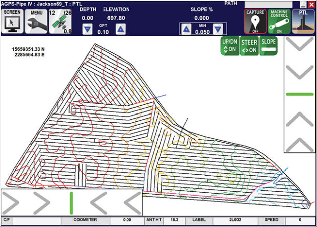
A contour map generated on-the-fly using LiDAR data housed on the Ontario GeoHub.
Improved mapping
LiDAR has helped improve soil and drainage mapping.
“LiDAR can detect the open ditch network, which is critical since the open ditch connects subsurface drainage pipes at field scale to natural rivers at watershed scale,” says Zeng. “The current stream network database only has natural rivers, and LiDAR can help to fill the gap of missing man-made ditches.”
Saurette says Ontario has been acquiring LiDAR data over the past few years and now has high-resolution data for large portions of the province’s agricultural regions.
OMAFRA has funded several recent LiDAR acquisition projects to support provincial efforts, he notes. The resultant data and products are made available to the public, thereby making the same base elevation data available to all users.
“Using the LiDAR data for planning and design can help offset in-field elevation surveys and costs for acquiring LiDAR data by individual tile drainage contractors and consultants,” says Saurette.
Data availability
Ontario currently has LiDAR data available for more than 227,624 square kilometres, and additional LiDAR acquisition is currently underway for the province, says Saurette.
There are many ways to access Ontario’s LiDAR data. There’s a central repository for the LiDAR data, which outlines the technical specifications, data inventory, and ways to access the data available at the Ontario Elevation Mapping Program site on the Ontario Geohub (https://geohub.lio.gov.on.ca/pages/ontario-elevation-mapping-program).
Besides making LiDAR data available, OMAFRA has recently added a tool to the Agricultural Information Atlas (AgMaps) (https://www.lioapplications.lrc.gov.on.ca/AgMaps/Index.html?viewer=AgMaps.AgMaps&locale=en-CA), which allows users to generate a 50 centimetre contour map after creating a box around their property or area of interest. This map is generated on-the-fly and pulls directly from the LiDAR data housed on the Ontario GeoHub, says Saurette.
In the U.S., Cook finds that downloading and processing introduces a lot of variables. He explains that the United States Geological Survey (USGS) site has data for many states, but that some states may have newer data available on their own websites.
From there, to process, thin down, and visualize the data is a multiple step process, depending on what software is being used, Cook says.
Zeng points to state-wide LiDAR data coming available, such as in Illinois (https://clearinghouse.isgs.illinois.edu/data/elevation/illinois-height-modernization-ilhmp), and Indiana (https://igic.memberclicks.net/indiana-s-new-3dep-lidar-data-and-informational-resources).
Higher accuracy can be achieved with an additional LiDAR scan at site by drone, Zeng says. The average contractor can know field height at an unprecedented accuracy, such as for leveling the ground.
“Post-processing is needed to derive the needed information or detected the objectives,” says Zeng. “For example, we developed methods to detect drainage open ditch — the layout, the channel cross section geometry — from LiDAR. It significantly reduces the time and effort of field survey.” DC
Print this page